Since September 2012 our team has aligned 260,309 roads in the United States. For this process we use fresh US government TIGER data to show where OpenStreetMap data is out of date, then we trace from imagery as needed and use road names from TIGER. (For a background on TIGER data in OpenStreetMap read Eric Fischer's blog post).

Here's the map showing the extent of the issue. Pink lines are the progress over US. Full interactive map.
We continue our work on TIGER with @MateoV's recent analysis that further focuses our TIGER work. This analysis looks only at areas with high Twitter traffic and focuses on missing roads, naming issues and road lengths over 30 meters.
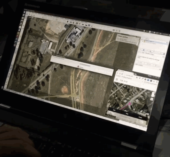
We've loaded the results of @MateoV's analysis into to-fix and work from there.
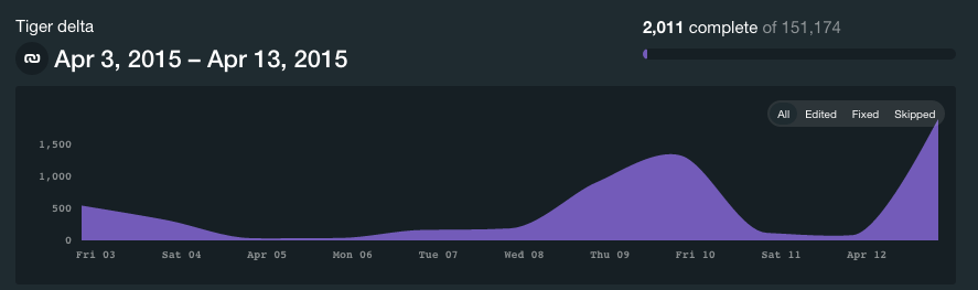
TIGER progress on the new to-fix dashboard. Current status: fixed 2,011 issues of 151,174 (all about the new dashboards)
Ongoing work with tile-reduce by @morganherlocker @ericfischer @MateoV @aaronlidman will allow us to focus our work even more, making sure our work on the map happens exactly where we need improvements.
Here are a couple of highlights of areas we updated:

Baton Rouge, Louisiana

Bryson City, North Carolina

Deltona, Florida

Wantage and Vernon, New Jersey
@mapbox/team-mapbox