Since MONTH YEAR our team has aligned XX,000 roads in the United States. For this process we use fresh US government TIGER data (for a background read Eric Fischer's blog post) to show where OpenStreetMap data is out of date, then we trace from imagery as needed and use road names from TIGER.
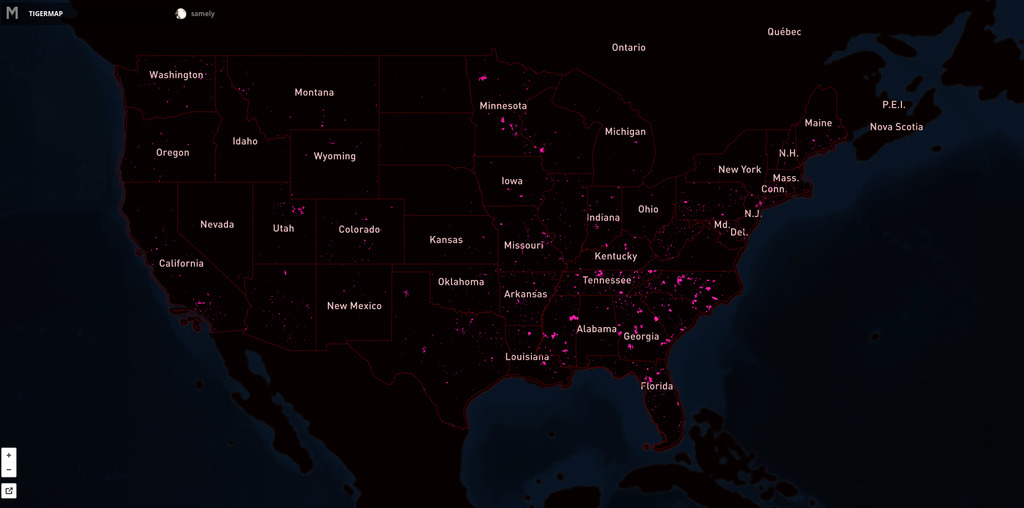
Here's the map showing the extent of the issue. Pink lines are the progress over US. Full interactive map.
![]()
Graph showing our teams edits on TIGER since MONTH YEAR.